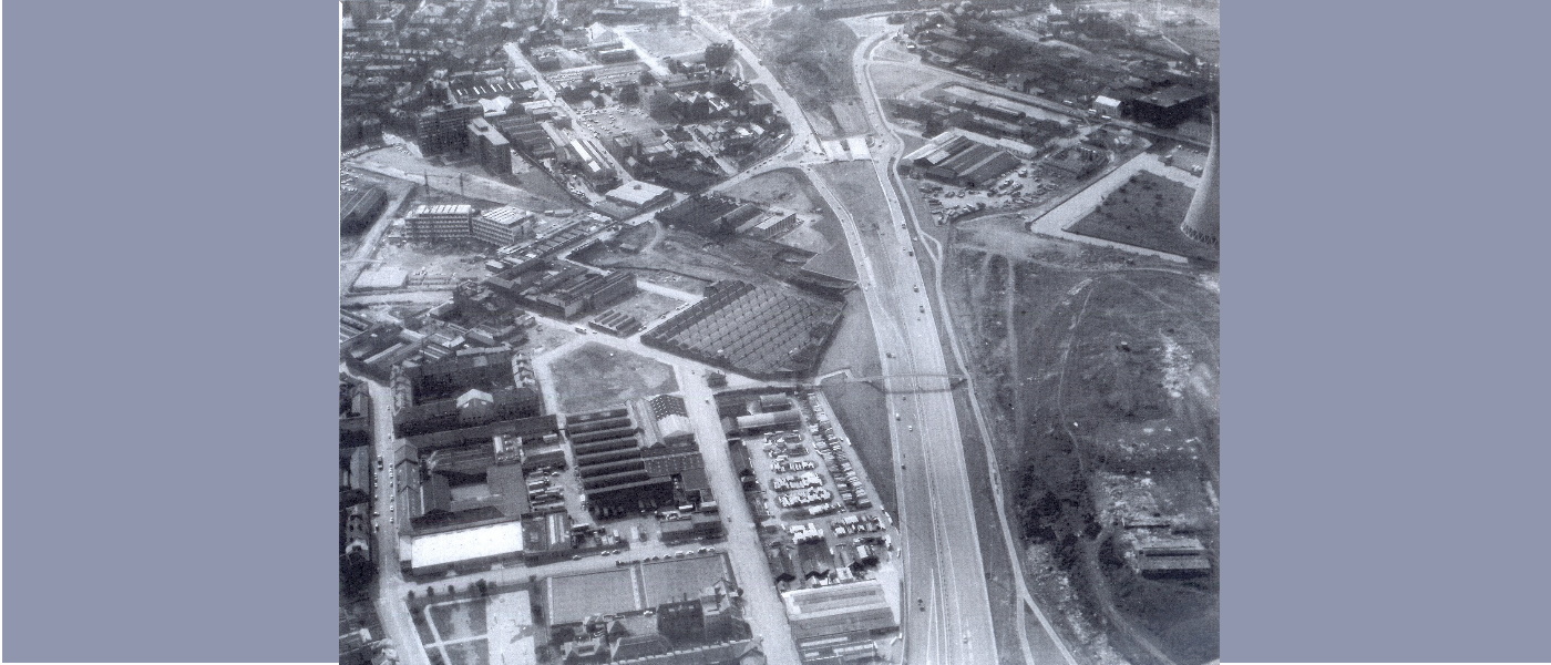
M8 schism (late 1960s or early 1970s)

This stunning aerial image shows the soon to be Sighthill Park, still known as Broomhill, on the right of the M8 motorway. Taken from the east, the division created by the M8 (here still under construction) is obvious. Equally obvious is the cooling tower of Pinkston power station top right, only a few hundred metres from where a stone circle would later be constructed. The industrial quality of the park is evident in this image too, with ruined warehouses (some of which sitting where the second version of the stone circle would be constructed) and patchy vegetation scarred by improvised pathways and vehicle tracks. The raised location where Sighthill stone circle would be built is marked by the cap of an airshaft that led down to the disused Buchanan Street railway tunnel far beneath. For a time during the removal of the stone circle in 2016, this shaft was uncovered, a terrifying inverted chimney leading down into the endless dark. This air photo presents an image of urban renewal but there was a long way to go, although at this point it would have been hard to predict what the next agent of change was to be.

